
Mt. Shasta Trip Report: 6/4/2023
Mt. Shasta Avalanche Gulch Route: June 3-4, 2023
A couple months ago, I bought a pack of drink coasters from a local woodworker in town. The coasters show the topography of six Cascade Volcanoes. When I noticed that Shasta was the only coaster whose volcano I hadn't climbed, I knew I had to go this spring-- especially with such a great snow year.
I was happy to make the 6.5 hour drive down from the Gorge, since it would be the most south I'd ever been in Oregon and the most north I'd ever been in California. And it was awesome that the mountain is just 20 minutes away from the city of Shasta!
The Approach
My group met up Saturday morning to sort gear and carpool over. The parking at Bunny Flat was nuts-- cars lined the side of the road for a half mile before the actual parking lot. Be sure to park on the side away from the cliff in case of rockfall.

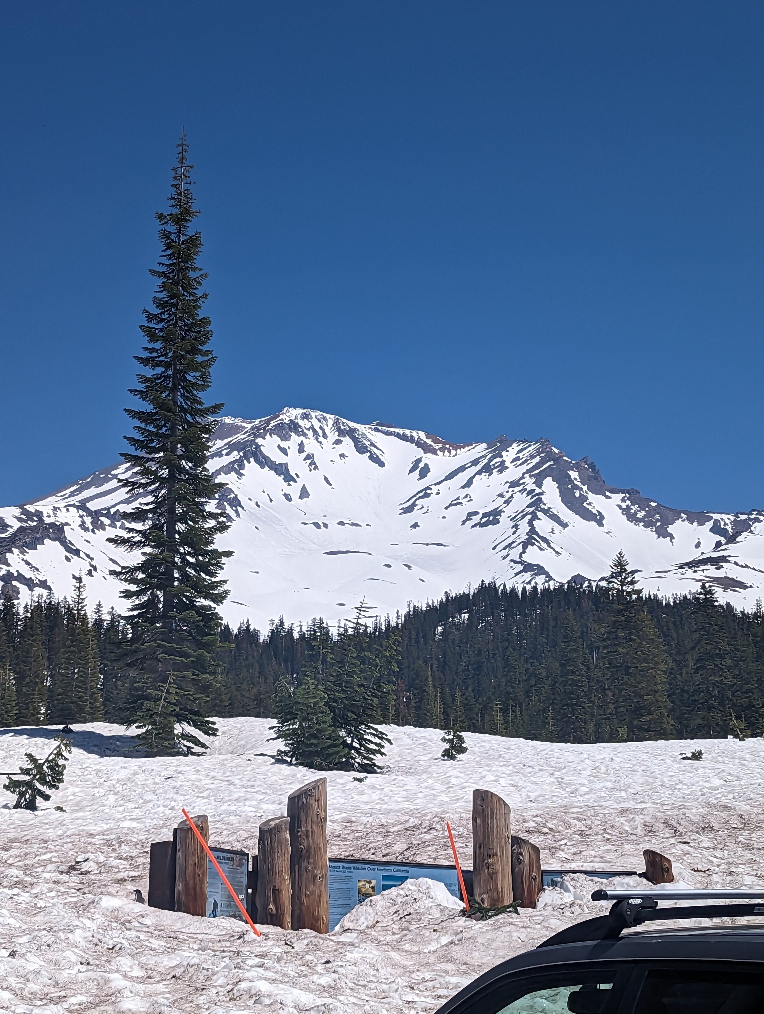
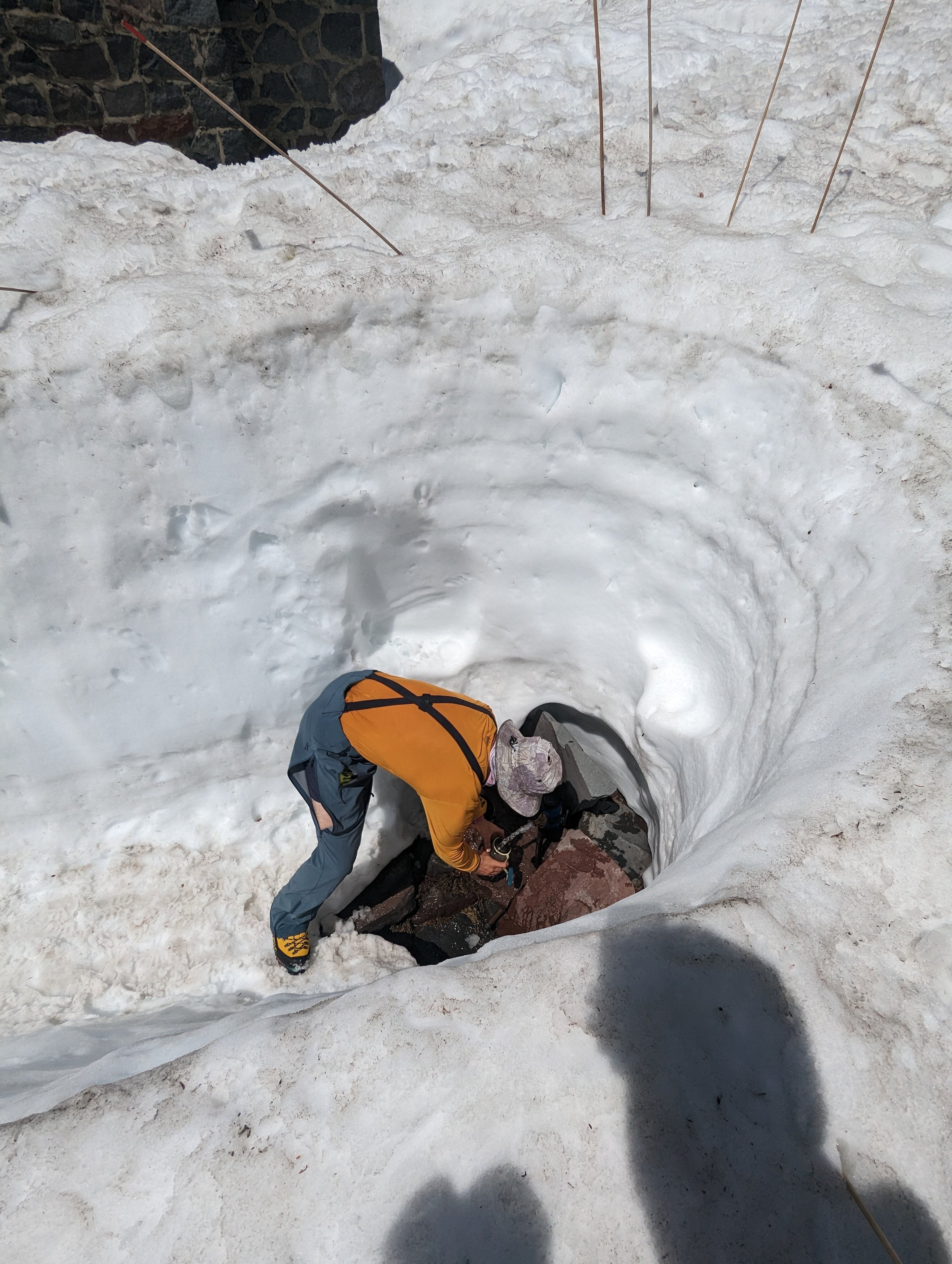
We left the lot at almost 1pm. From the trailhead, the snow was soft yet firm, making for easy stepping up the trees into Horse Camp, where we stopped to fill up creek water. I poked inside the shelter, too.


It was an easy ~2.5 mile, ~2,500' elevation gain to our camp at 51.50 Flat. I got to work digging out my shelter. The snow was excellent for cutting out chunks with a shovel to build walls, though it wasn't windy that day or night, so it might not have been too helpful. Of course, I anchored my tent since even a little wind could blow it off the mountain. We collected a few sticks at treeline to use as anchors.

A team member headed up the Gulch towards camp


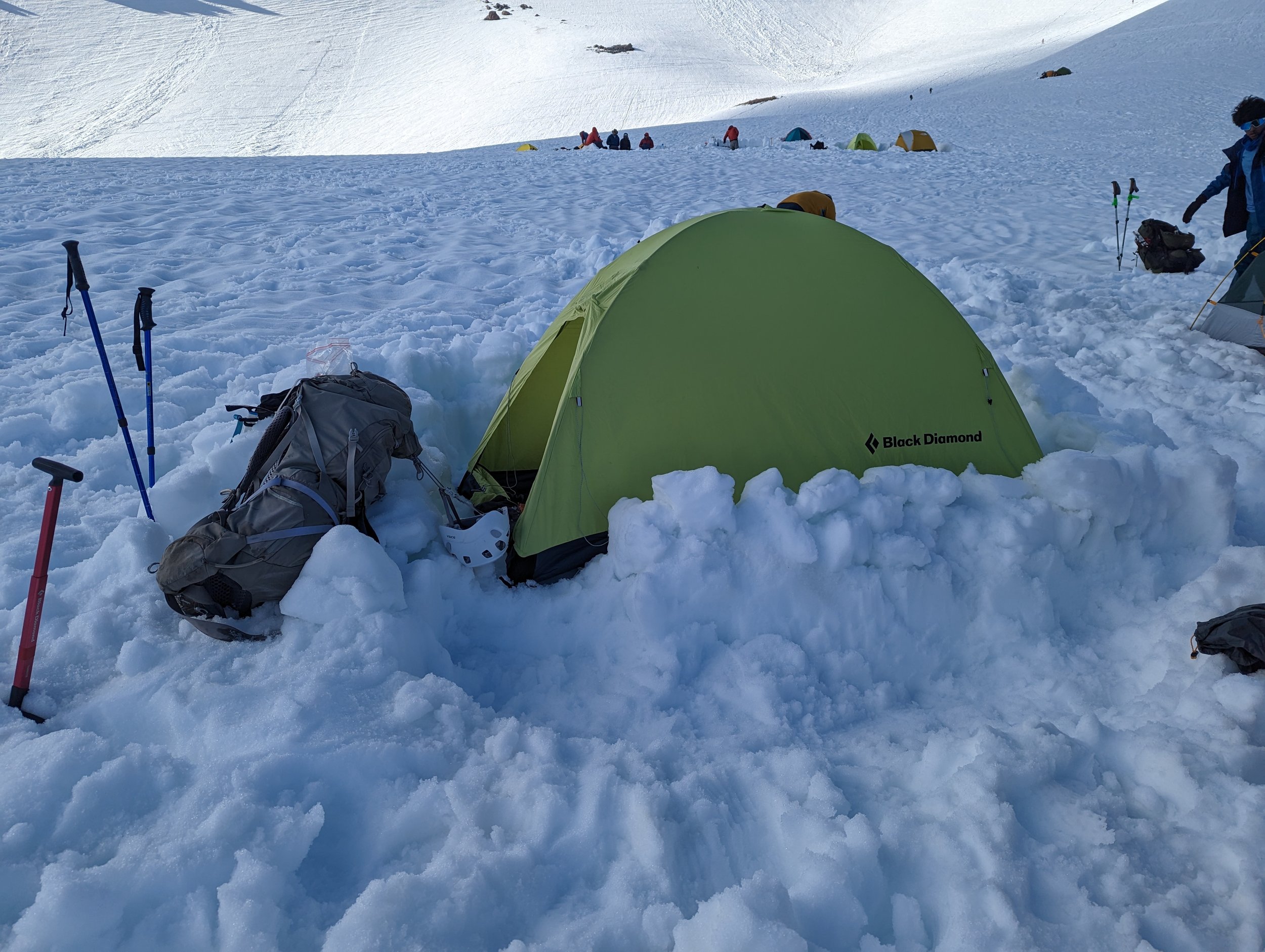
I borrowed a 4-season mountaineering tent to try. Temps were mild so I didn't give it a hard test, but it was comfy.
After melting plenty of drinking water and rehydrating dinner, I crawled into the tent around 8pm with a wakeup call of 1am. It never got cold or windy, but I tend to have trouble sleeping the first night anywhere, so I mostly just had "horizontal time." Any rest is beneficial!
The Ascent
We woke at 1am and found out that our stove had stopped working. Thankfully, we'd melted plenty of water to drink the evening before, but I didn't get to enjoy my mandatory cup of coffee hot. Glad I brought my "emergency" packet of local instant coffee that tastes good cold!
Just after 2am, we left 51.50. It seemed like we were towards the back of the pack, since most folks had camped at Helen Lake and had started a bit earlier. The full moon was lovely to see and helped illuminate our way.


We switchbacked up in steep areas, happy with the snow conditions-- it had barely crusted over, allowing us firm snow without sinking through or sliding. Much of our way up the gut of the Gulch had a clear bootpack, making for easy footing. With it being so near the solstice, we had an early sunrise.
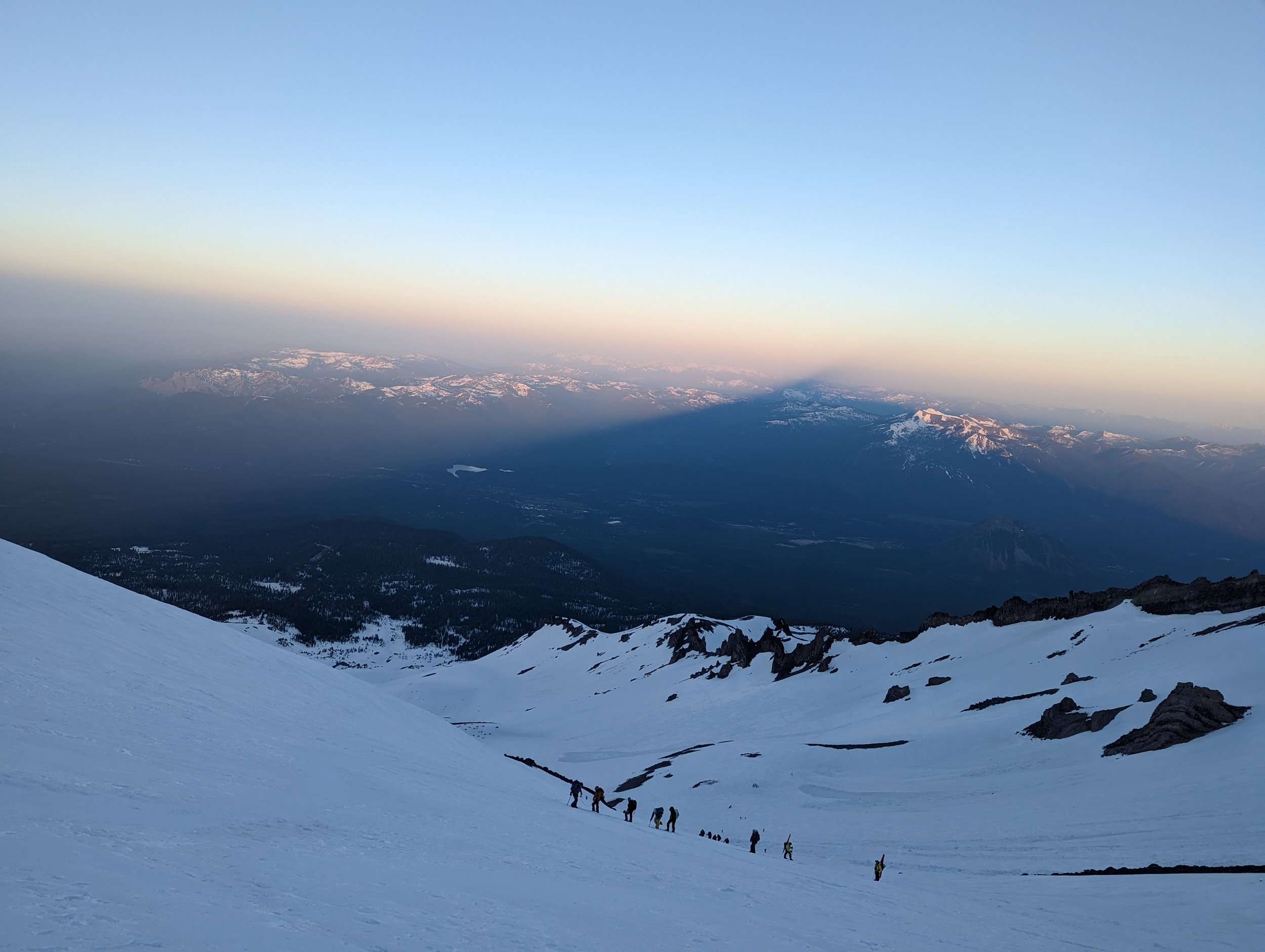
Shasta’s shadow at sunrise
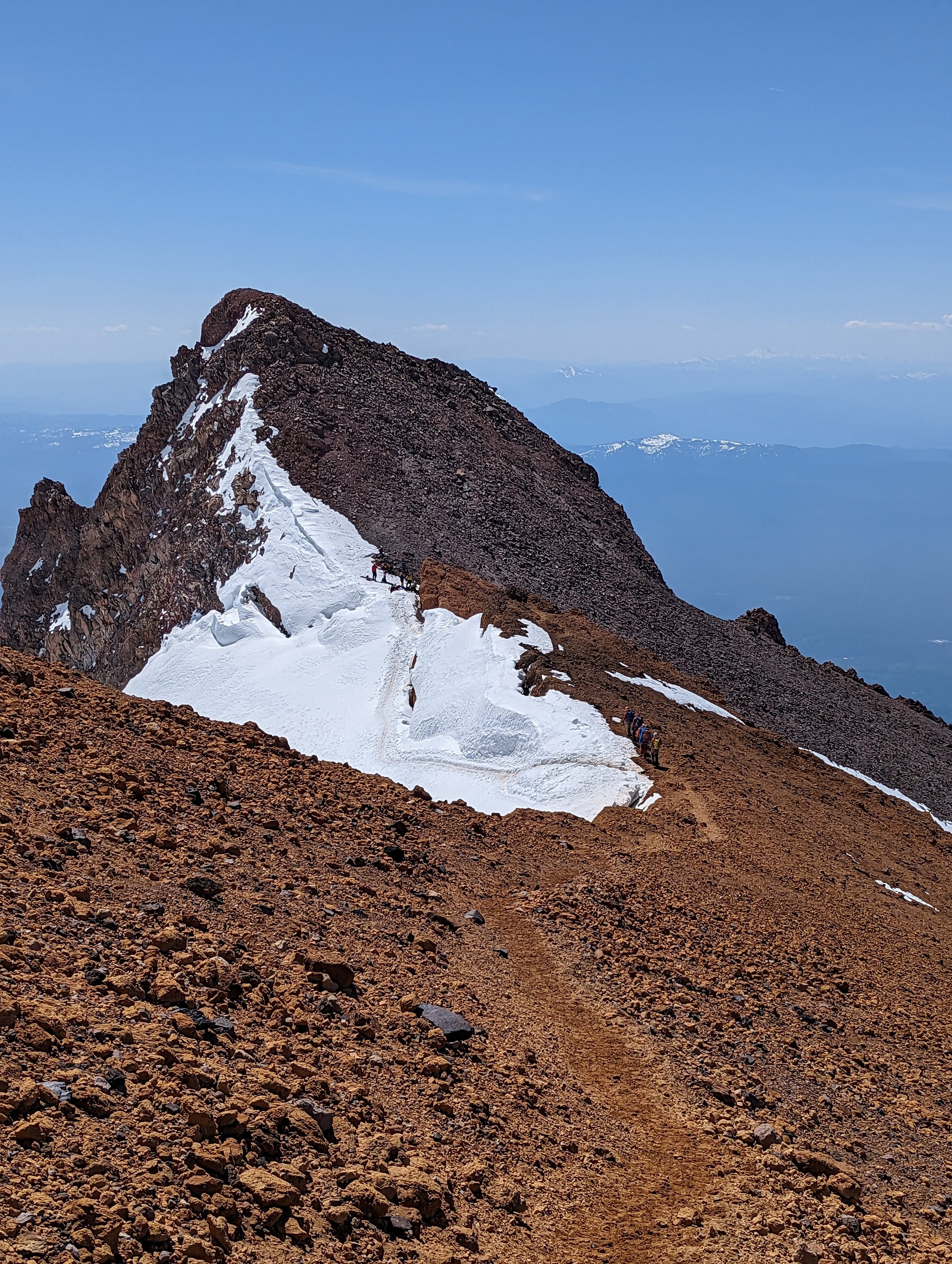
We started to catch up toward other groups and didn't take a long break until we reached Redbanks by Thumb Rock. We went to climber’s right of the Heart to get there.

Looking at Short Hill from The Thumb
From there, it was a short and narrow traverse through snow and dirt to Short Hill, which still had snow but was where we started to encounter rock/dirt. We kept our crampons on for some short dirt sections before taking them off at the bottom of Misery Hill.
Misery Hill was completely bare. All skiers left their skis at the base of the hill. From there, up the rock! There was an easy-to-follow dirt trail to switchback up it without rolling an ankle.


I see why they call it Misery Hill-- when you get to the top, you still have about 300' to gain, but it looks a lot worse. Thankfully, it doesn't feel so bad. We donned our crampons again for this final push for extra traction.
When we reached the summit, there were a bunch of people scattered about. Mind your footing; it's rocky and can get narrow with so many people sharing the space.


I donned my tutu for my summit photo. After I put it back away, I overheard two women talking about their tradition of climbing mountains for one of their birthdays. One poked fun at the other for forgetting their celebratory birthday tutu. "Want to borrow one?" I asked. Yay, I saved their birthday photo!

Tutu for extra warmth ;)
The Descent
We picked up the pace on the way down, backtracking all the way to Redbanks without much to note. Plenty of folks were still making their way uphill, and it was getting hot. Another reason to start early.


From just below The Thumb, we were able to glissade through much of the way down the steep gulch back to camp! The top of the chutes were still very firm, which made controlling speed a big task. I had to use my axe as a rudder constantly. That part wasn't great glissading, but partway down the snow warmed up a good amount and it became a blast. Of course, the lower I got, the slushier it got, and the final chutes were excellent for glissading!


I reached camp before the rest of my group so I tried to take a nap in the tent. Once again, unsuccessful at actually sleeping, but at least I was horizontal.
After we all packed up camp, we found more glissade chutes on the way back towards Bunny Flat. Instead of passing Horse Camp on our descent, we stayed on the strict Avalanche Gulch route, dumping us out from the other side at the trailhead pit toilets. Those final 1-2 miles were extremely slushy and very messy from the hoards of people who left before us. Heel plunging and poles helped a ton.
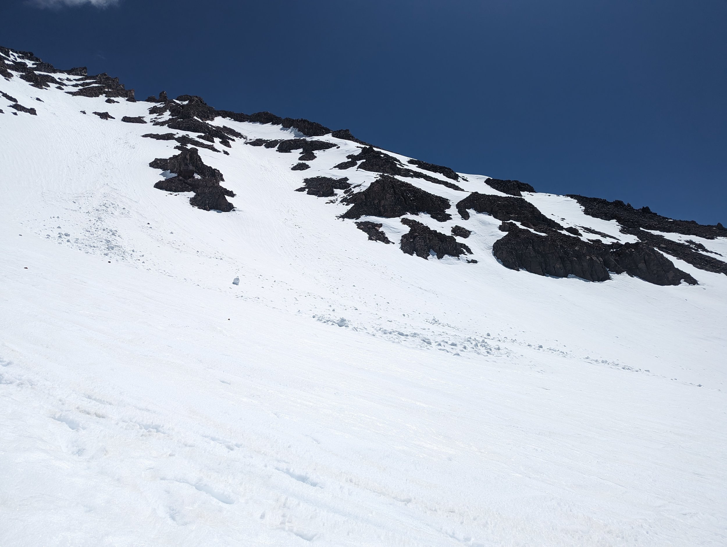
Avalanche Gulch is aptly named; we saw plenty of debris and a very clear slide path.
Stats
Okay-- so you're wondering how "hard" it is. Here are some numbers to help you think about it. Keep in mind that my natural pace is faster than that of my whole group's. I had to be proactive in staying warm during breaks. My average heart rate was only 114 bpm (during an easy run it's in the 140s; this shows how the pace was easy for me and how many breaks we took).
That said, even though we'd started later than most parties, we passed a few and seemed to have a decent pace even though it felt a bit slow for me. Moving time from camp to summit was around 5 hours, plus about 2 hours' cumulative of breaks = 7ish hours from camp, putting us at the summit before 9am.
Elevation gain from our camp at 51.50 to summit was ~4,600 and ~2.5 miles.
Total climb elevation gain ~7,100' and ~10 miles, with most elevation gain after camp.
Hazards
Rockfall: This route was pretty straightforward to me. There were no crevasses, but the rockfall danger is real. While we were climbing, somebody in another party suffered an open tib-fib fracture due to rockfall. We saw the helicopter approach for a rescue. Be super rock aware: start early, finish early. Some experienced Shasta climbers said being done with the ascent by 10/11am that day would be imperative.
Lack of sleep: And for me-- dang, was I sleep deprived, which is certainly a hazard worth being mindful of. Friday night I tried to sleep in my car, which was more like "horizontal time" than sleep. And Saturday was our on-mountain night before the alpine start. So, I had next to no sleep for two nights before/during the climb. I could tell the difference between physical exertion tiredness and lack of sleep exhaustion, and it was certainly the latter. My muscles/endurance felt pretty great, but I found myself daydreaming about being on a mattress or even the pad in my tent. I'd never felt so sleep deprived in the alpine before, so it may be worth my money next time to book a hotel the night before a climb.
Keep in mind, conditions are quickly changing so much of this may be obsolete in the days/weeks after writing. Have fun out there!
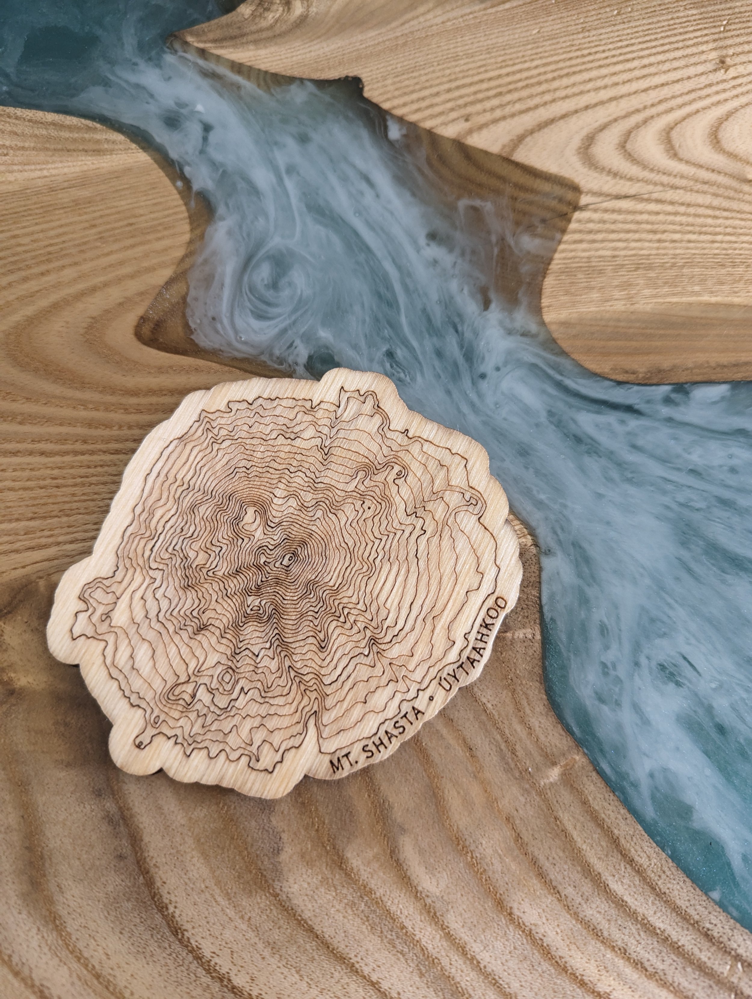
The coaster that started this. Find a pack here.